
 FOX 51 Gainesville Crime
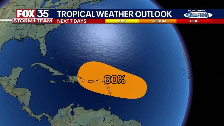
Hurricane Erin forecast: Latest path, cone, track
Hurricane Erin weakened slightly Monday night but remained a Category 4 storm with sustained winds of 130 mph as it churned northwest, bringing dangerous surf and renewed concerns about beach erosion along Florida’s Atlantic coast.
What we know:
Forecasters at the National Hurricane Center are monitoring a tropical wave trailing Hurricane Erin in the eastern Atlantic.
The system is producing disorganized thunderstorms but could strengthen as it moves west to west-northwest at roughly 20 mph.
CLICK TO DOWNLOAD THE FOX LOCAL APP
Meteorologists say the disturbance has a 10% chance of developing into a tropical cyclone within two days and a 60% chance over the next week.
The wave is expected to approach the Leeward Islands by Friday.
Wh

 Local News in South Carolina
 FOX 13 Tampa Bay Crime
 Orlando Sentinel
 FOX 13 Seattle Crime
 America News
 WCNC Charlotte Weather
 KRWG Public Media
 Associated Press US News
 Reuters US Business