
 The Jersey Journal
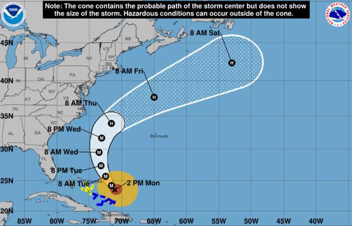
A high risk of dangerous rip currents and potential coastal flooding will impact New Jersey’s shoreline through Thursday as Hurricane Erin passes far offshore, with significant marine and beach hazards expected.
The National Weather Service says there’s a high risk for dangerous rip currents developing through Wednesday evening for coastal areas, with breaking waves expected to increase from 3 to 6 feet on Tuesday to 5 to 8 feet on Wednesday.
Latest N.J. weather news
3 Jersey Shore beaches ban swimming due to dangerous surf. Hurricane Erin expected to make it worse.
N.J. weather: This town got a month’s worth of rain in one night
Golfer struck by lightning at popular N.J. course, police say

 WCBD News 2
 WTVR CBS 6
 WBRZ News
 America News
 The Columbian
 CNN
CNN FOX 13 Tampa Bay Crime
 New York Post
 KDKA
KDKA KRGV Rio Grande Valley
 Daily Herald Lifestyle
 Bonner County Daily Bee
 E Online