
 FOX 13 Tampa Bay Crime
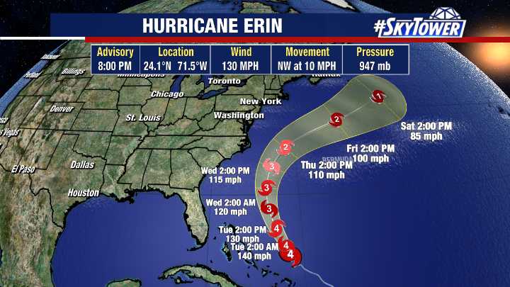
TAMPA, Fla. - Hurricane Erin has restrengthened to a Category 4 storm as it turns northwest and is expected to remain east of the U.S., according to the National Hurricane Center.
Hurricane Erin's track
As of 8 p.m. Monday, Erin was located at 24.1N and 71.5W with maximum sustained winds of 130 mph.
The storm is moving west-northwest at 10 mph.
FOX 13 meteorologists say the storm’s center is expected to pass several hundred miles east of Florida before curving northeast, keeping its core entirely offshore of the U.S. East Coast.
Even without a direct hit, Erin’s close pass will generate life-threatening rip currents and powerful swells along much of the Eastern Seaboard.
Mandatory evacuations have been ordered for parts of Hatteras Island, North Carolina, where 15–20-foot break

 FOX 5 Atlanta Crime
 NBC News
 York Dispatch
 Orlando Sentinel
 FOX Weather
 CNN
CNN Press of Alantic City Business