
 FOX 13 Tampa Bay Crime
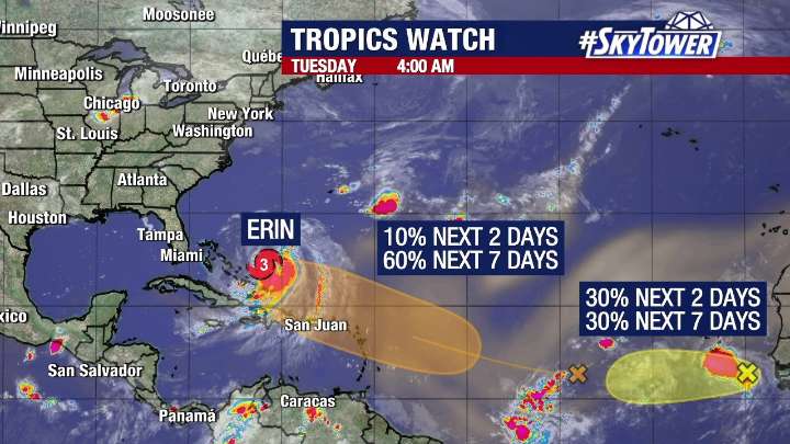
TAMPA, Fla. - Hurricane Erin is moving east of the U.S. coast and will bring strong waves and rip currents to Florida's east coast – and it comes as the National Hurricane Center is eyeing two more tropical waves in the Atlantic.
Hurricane Erin's track
As of 2 p.m. Tuesday, Erin was located at 26.1N and 72.5W with maximum sustained winds of 105 mph.
The Category 2 hurricane is moving north-northwest at 10 mph.
FOX 13 Meteorologist Dave Osterberg says that while Erin has weakened after previously reaching Category 5 strength, its wind field has expanded.
That could bring tropical storm-force wind gusts to the Outer Banks of North Carolina, where tropical storm and storm surge watches are in effect.
What will likely be the most significant impact for the U.S., however, is life-th

 FOX 5 Atlanta Crime
 York Dispatch
 Orlando Sentinel
 RadarOnline
 NBC News
 AlterNet
 FOX News
 America News
 The Babylon Bee