
 WFMJ-TV Politics
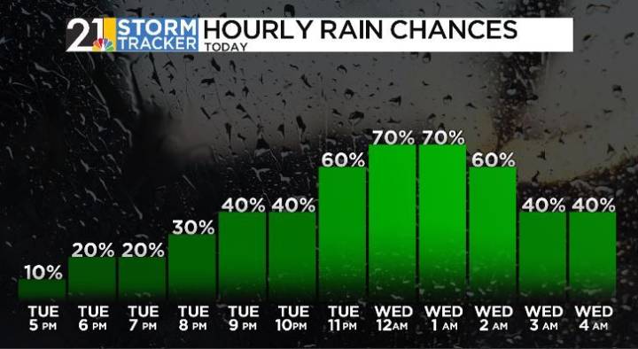
Our next cold front will bring wet weather on Tuesday and into Wednesday, followed by dry weather that will remain in place for the rest of the week.
A shower or thunderstorm will occur around or just before sunset on Tuesday, but could become widespread at times closer to midnight and into the earliest hours of Wednesday morning. Any thunderstorm could produce heavy rainfall Tuesday night into Wednesday morning.
Showers and maybe a thunderstorm will remain scattered during the pre-dawn hours on Wednesday. Showers will continue to linger Wednesday morning, but models have been hinting at a drier trend for the second half of the day. Expect Wednesday to be breezy at times with more clouds than sunshine and high temperatures in the upper 70s.
In the wake of the cold front, more comfortabl

 The Greenville News
 Daily Voice
 WYMT
WYMT KAKE
KAKE WMTV NBC15
 WBRC
WBRC Seeking Alpha Stock
 NBC News NFL