
 News4JAX
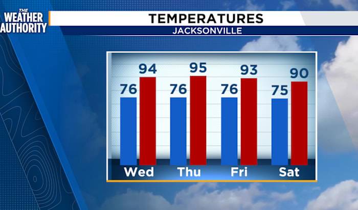
A hot and humid afternoon with a few showers and thunderstorms moving inland, under the northeasterly breeze. Most of the activity is south of I-10 and west of the St. Johns River. These will continue to move toward Highway 301 and I-75 through sunset.
The pattern remains the same as Hurricane Erin will move east of Florida and SE GA through the day on Wednesday. Limited showers and storm activity, around 20 - 30 percent, as temperatures hover just above our seasonal levels.
Hurricane Erin is a Category 2 hurricane. The turn to the north will continue as Erin heads into the deep Atlantic this week. Rip current risks along our beaches will remain High.
Near the Leeward Islands, A tropical wave located over the central tropical Atlantic continues to produce disorganized showers and thunde

 The Greenville News
 Daily Voice
 Newsday
 WYMT
WYMT Click2Houston
 MENZMAG
 The Mercury News Celebrity