
 News Channel 36
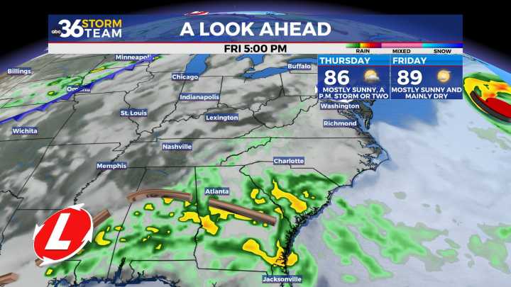
Temperatures should back down a few degrees for afternoon highs
The stretch of hot August weather kept its grip on Central and Eastern Kentucky Tuesday, as an upper-level ridge of high pressure lingered over the region. Afternoon highs pushed into the upper 80s and low 90s, and when you factored in the humidity, it felt just a touch hotter. Sunshine dominated for most of the day with mainly dry skies, though some relief is on the way as we look ahead to midweek.
Storm Chances Return Midweek
A frontal boundary will dip into the Ohio Valley on Wednesday, bringing back the chance for scattered showers and thunderstorms. Some storms could even pop late Tuesday night into early Wednesday as a preview of what’s to come. While coverage won’t be widespread, any storms that develop could pack a

 The Greenville News
 Daily Voice
 Newsday
 WYMT
WYMT WMTV NBC15
 MENZMAG
 NFL New York Jets
 Raw Story