
 13 On Your Side
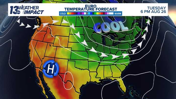
MICHIGAN, USA — After a very warm and humid summer, some relief is on the way next week.
Our first real fall-like air mass of the season moves in early next week. This means high temperatures in the 70s and 60s, very dry air and lows in the 50s to even 40s.
The end of August will likely be cooler and drier than average.
The Climate Prediction Center's latest 6-to-10-day temperature outlook highly favors much of the Midwest and Great Lakes region having a pattern shift to cooler weather.
With average highs near 80 degrees, this puts West Michigan firmly with highs in the 70s to even 60s.
The rest of this week will feature highs staying in the 80s, close to average.
The warmest day should be Friday over the next ten days. Highs will climb into the mid 80s on Friday before a strong co

 The Greenville News
 Daily Voice
 Newsday
 WYMT
WYMT Click2Houston
 KAKE
KAKE MENZMAG
 AlterNet