
 cleveland.com
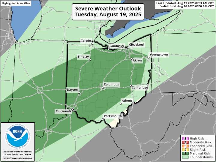
CLEVELAND, Ohio — A warm front lifting north across Northeast Ohio Tuesday will usher in warmer, more humid air, fueling showers and thunderstorms ahead of an approaching cold front.
Scattered rain moving through Northwest Ohio in the morning is expected to reach the Interstate 71 corridor around midday, according to forecasters with the National Weather Service in Cleveland.
While this first round isn’t expected to be severe, it may set the stage for stronger storms to redevelop in the afternoon, especially south and east of a line running from Marion to Akron.
“If storms can redevelop this afternoon, localized damaging winds and heavy rain remain possible,” forecasters wrote in a mid-morning update.
As a result, the Storm Prediction Center has placed much of Central and Northeast

 NBC News
 New York Post
 America News