
 Click2Houston
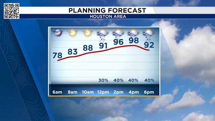
Wednesday’s Forecast:
We’re tracking another hot and muggy day with feels-like temperatures in the triple digits and more isolated thunderstorms afternoon into the evening.
You can track radar here:
We’ll watch and track for the chance of isolated thunderstorms for areas up to the north and south around 3 p.m., a line of isolated showers from Columbus to The Woodlands around 6 p.m., and the potential for heavier storms on the east side around 9 p.m.
A stalled front drapes into southeast Texas Thursday and this will bring more widespread rain with the potential for street flooding. This flooding treat includes Friday too.
Tracking hurricane Erin:
Hurricane Erin: Heavy rainfall is expected across parts of Hispaniola, Turks and Caicos, and the Bahamas, particularly east of San Salvador

 FOX 4 News Arlington
 KRGV Rio Grande Valley
 WWL-TV
 Spectrum News Louisville
 KBTX News 3
 FOX 10 Phoenix National
 KGNS
KGNS Mediaite