
 Lubbock Avalanche-Journal
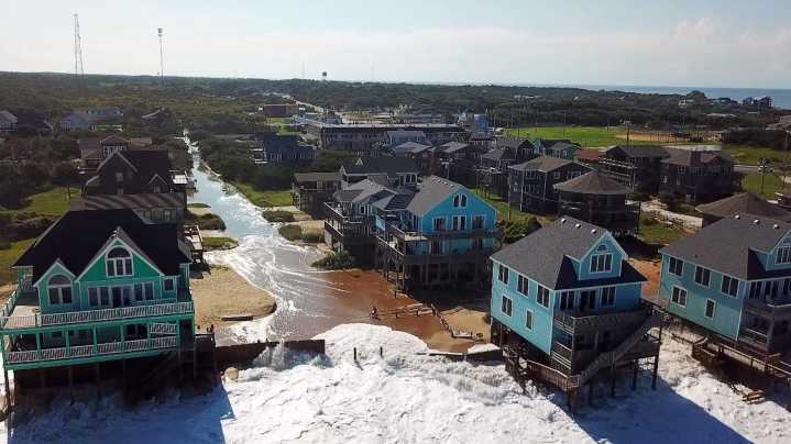
Video shows a tidal storm surge enveloping homes along North Carolina's coast as Hurricane Erin moved through the Atlantic Ocean, gaining momentum.
Aerial footage shot using a drone in the state's Outer Banks on Tuesday, Aug. 19, shows waves slamming into raised, colorful beach houses along the shore, the storm's deluge creeping its way inland.
Hurricane Erin’s surge , captured flooding the Buxton neighborhood and surrounding coastal communities, came as evacuations and swim bans were issued in the area for safety measures.
The unincorporated community on Hatteras Island near Cape Hatteras is in Dare County.
Where is Hurricane Erin headed?
On Wednesday, Aug. 20, an early morning advisory from the National Hurricane Center announced Erin was located about 455 miles south-southeast

 KPLC
KPLC Detroit Free Press
 America News
 CBS News Video
 Arizona Republic
 CBS News
 The Atlanta Journal-Constitution Crime
 WCNC Charlotte Weather
 The Travel
 The Daily Beast