
 Shelby Star
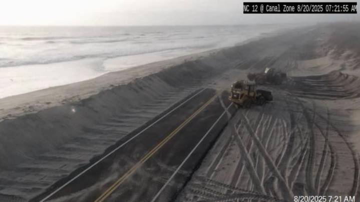
With Hurricane Erin pushing dangerous, life-threatening swells hundreds of miles ahead of its eye, Gov. Josh Stein warned North Carolinians to play it safe even though the storm was expected to pass the Tar Heel State well offshore.
“I want to reinforce taking the storm seriously because it’s a serious storm and conditions can deteriorate quickly," he said during press conference Aug. 20 in Raleigh.
As of 11 a.m. Aug. 20, Erin − now 500 miles wide, or roughly the length of North Carolina − was about 360 miles south-southeast of Cape Hatteras, moving north-northwest at 13 mph with maximum sustained winds of 110 mph. A Category 2 storm, Erin is forecast to grow in size while moving over the western Atlantic through the week, according to the National Hurricane Center.
Much of the Outer Ba

 America News
 CBS News Video
 The Columbian
 Associated Press US and World News Video
 CNN
CNN New York Post
 FOX 13 Tampa Bay Crime
 Atlanta Black Star Entertainment