
 FOX 26 Houston
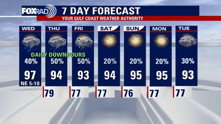
HOUSTON - You want to have your umbrella handy around the time you leave the office Wednesday as thunderstorm chances increase in the afternoon. The tropics also remain active as Hurricane Erin has made its turn to the north in the Atlantic as it passes east of Florida.
Stormy Wednesday ahead
A weak frontal boundary approaching from the north will increase shower and storm chances through the end of the week. There is a 1/5 risk for some stronger storms to pulse up this afternoon/evening.
Heavy rain, frequent lightning and the possibility of damaging wind gusts are the main weather threats today. In addition to the severe risk, there is a 1/4 chance of isolated street flooding, especially in areas that have seen heavy rain over the last few days.
Afternoon temperatures to soar again

 FOX 13 Seattle Crime
 Fox 26 Liberty County
 FOX 26 Texas
 FOX 4 News Arlington
 Star Beacon
 KICKS 105
 WTOP
WTOP Raw Story
 The List