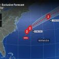
As Hurricane Erin churns just off the Atlantic coast of the United States this week, AccuWeather meteorologists are warning that the storm’s powerful winds will generate massive seas offshore. These waves will travel toward the shoreline, producing pounding surf, frequent and strong rip currents and considerable beach erosion from Florida to Maine.
Erin remains a large and dangerous hurricane even though winds are not as intense as they were over this past weekend when it was a Category 5 storm. Tropical storm conditions now extend outward up to 265 miles from the eye, while hurricane conditions reach about 90 miles from the center. As of Thursday morning, Erin had moved closer to the U.S. and at one point was about 200 miles to the east-southeast of Cape Hatteras, North Carolina. The Cat

 AccuWeather Severe Weather

 WJLA
WJLA MassLive
 ABC6 Rhode Island
 America News
 Local News in North Carolina
 CBS News Video
 WCNC Charlotte Weather
 People Human Interest
 Raw Story