
 Hattiesburg American
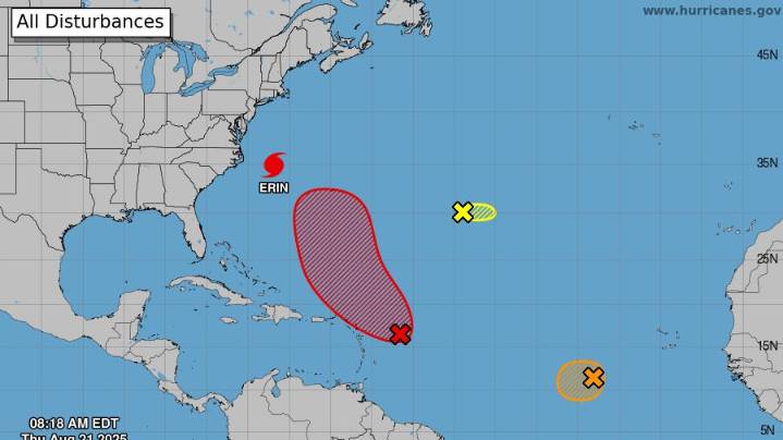
As Hurricane Erin pulls away from the East Coast and heads out to sea, forecasters are also watching the next weather disturbance in the Atlantic Ocean, a developing tropical wave that could become Tropical Storm Fernand (pronounced fair-NAHN) in the days ahead.
It's one of three developing systems the National Hurricane Center is tracking in the Atlantic on Aug. 21.
According to the Aug. 21 morning report from the hurricane center , "an area of showers and thunderstorms associated with a tropical wave located a few hundred miles east of the Leeward Islands has changed little over the past several hours."
The system is marked by the red "x" on the map below.
However, the NHC added that "environmental conditions appear conducive for further development of this system, and a tropic

 NBC News
 Fox 11 Los Angeles Sports
 Associated Press US and World News Video
 WTOC 11
 FOX 10 Phoenix Latest
 New York Post
 NBC10 Boston Entertainment
 Deadline Business