
 ABC4 News
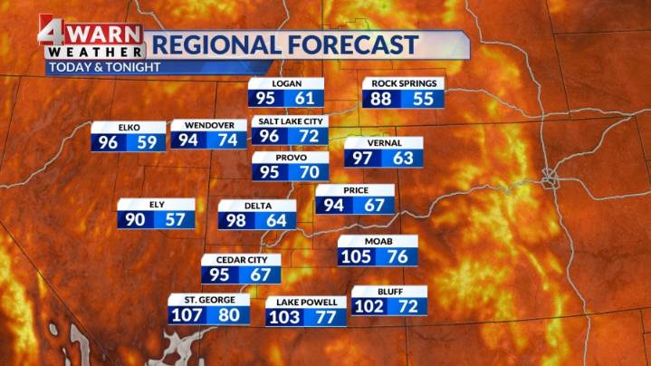
SALT LAKE CITY (ABC 4) - Happy Thursday, Utah! It's been a sunny start for SW Utah as the heat continues to build. Highs will warm into the 106-108 range through Friday. An Extreme Heat Warning is in effect for Lower Washington County due to the prolonged period of stifling conditions through Friday evening.
Across the Wasatch Front, a surge of monsoon moisture is moving across the region. This means increasing chances of rain starting Thursday afternoon across the mountains and ramping up Friday through the upcoming weekend across all of the Beehive state. Some of these scattered showers and storms could produce some decent downpours which could lead to some flash flooding issues across our state and national parks. A marginal risk for flooding develops across S. UT by Friday afternoon,

 FOX 13 News
 KSL Utah
 AlterNet
 New York Daily News Politics
 Planet F1
 MENZMAG
 Washington Examiner