
 FOX 13 News
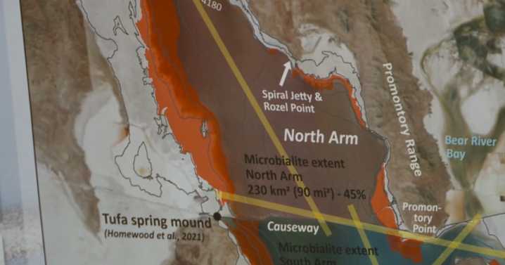
WOODS CROSS, Utah — Utah's Department of Natural Resources is utilizing LiDAR technology to help map the Great Salt Lake.
"It is a topo-bathymetric LiDAR sensor that operates by basically recording the distance from the aircraft to the ground. It uses a green wave length... but that allows us to get through the water column and actually penetrate the water and get to the bottom this," said Josh Novak with Dewberry, which is working with the data gathered from teh project.
Such an effort has never really been tried before on the Great Salt Lake and the Department of Natural Resources said if the project is successful, it could help other saline lakes across the country.
"What we noticed as the lake dropped to historic lows in the fall of 2021, and then again in the fall of 2022, was that

 Newsday
 NBC News
 Reuters US Domestic
 Essentiallysports Motorsports
 Essentiallysports Football
 The Conversation
 Cover Media
 Tribune Chronicle Sports
 PennLive Pa. Politics