
SALT LAKE CITY (ABC 4) - Happy Friday, Utah! A big pattern change is beginning to shape up for the region. Today will continue to bring the extreme heat to SW Utah, so Extreme Heat Warnings remain in effect. The rest of the Beehive state will remain warm with highs in the 90s. The monsoon pattern will begin to spread isolated to scattered showers and storms north across Utah Friday into Saturday afternoon. Some of these scattered showers and storms could produce some decent downpours which could lead to some flash flooding issues across our state and national parks. A marginal risk for flooding develops across S. UT by Friday afternoon, spreading north across the state by the end of the weekend. The overall pattern screams wetter than average conditions for Utah through most of next week.
Extreme Heat Continues Across SW Utah, with the Monsoon pattern ramping up into next week
 ABC4 News7 hrs ago
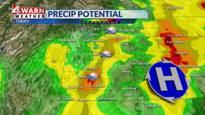
138

 KSL Utah
 CBS News
 PennLive Pa. Politics