
 FOX 8 News
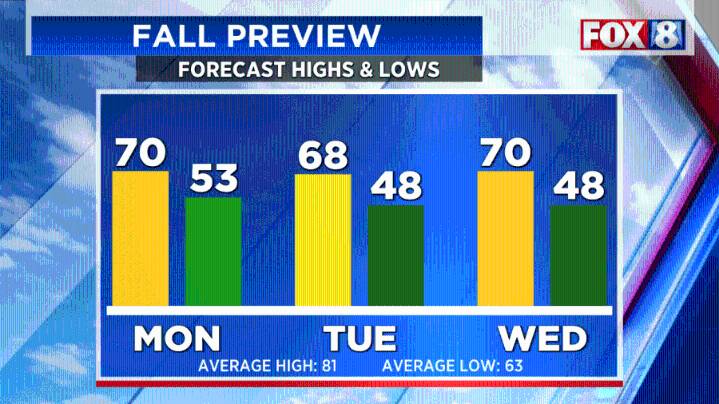
(WJW) -- Lows Sunday morning will be in the lower to mid 60s.
Cooler and less humid air will spill into Northeast Ohio behind the front. Sunday will not be as warm, with highs in the mid to upper 70s.
Sunday will be a mostly dry day. However, a small brief rain shower or two cannot be ruled out.
We will get a fall preview for the start of the workweek. Highs on Monday, Tuesday, and Wednesday will only be in the upper 60s to near 70 degrees, which is 10 to 15 degrees below normal for the end of August.
Temperatures could dip into the upper 40s in some spots Tuesday night and Wednesday night. Temperatures could be near record lows.
The cool air moving over the warm lake will trigger scattered lake effect rain showers on Monday and Tuesday. Right now, it looks like the higher coverage of

 The Washington Post
 Essentiallysports Football
 ABC News Weather
 New York Post
 Associated Press US News
 WITN-TV
 WKOW 27
 KSNB Local4 Central Nebraska
 KOMU 8
 FOX News