
 WKYT
WKYT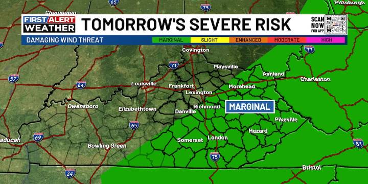
LEXINGTON, Ky. (WKYT) - Isolated thunderstorms continue into our Wednesday forecast ahead of some organized activity reaching us Thursday.
A few folks will start off with fog, but mainly cloudy skies across the commonwealth as we start off our Wednesday. A few lingering thunderstorms are sticking around after the overnight for south central Kentucky, but will taper off just after sunrise.
More scattered chances are present in the afternoon this Wednesday, mainly for eastern Kentucky.
Our first of 2 cold fronts approaches tonight as strong storms show up on Thursday morning. There is a low-end severe risk for parts of the state on Thursday morning as thunderstorms will bring in some strong winds. The line of storms will push deeper into eastern Kentucky by the early afternoon hours.
Hav

 Charleston Gazette
 Tucson News Now
 Corpus Christi Caller-Times
 New York Post
 NewsTalk 1280
 The Weather Channel
 AlterNet