
 WFMJ-TV Entertainment
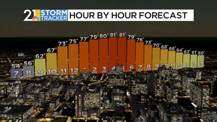
High pressure sitting to our east will keep us dry and clear on Wednesday. High temperatures will reach 80 degrees for the first time in over a week with just a couple of patchy afternoon clouds. Clouds will increase overnight as a cold front approaches from the west, and a shower or two will be possible before daybreak.
Showers will be likely during the morning and midday hours on Thursday with the passage of that front. A few thunderstorms will be possible as well, with the potential for gusty winds. In between the raindrops, it will be a cloudy and cool day with temperatures struggling to get out of the mid-60s.
Skies will start to clear out Thursday evening, and patchy fog will develop overnight. After some fog early, skies will turn partly sunny on Friday with a slight chance for an

 The Washington Post
 The Oregonian Public Safety
 WCBI-TV
 WXYZ Detroit
 NewsChannel 5 Nashville
 FOX 11 Riverside County
 KWCH
KWCH The Daily Record Weird News