
 4 News Now
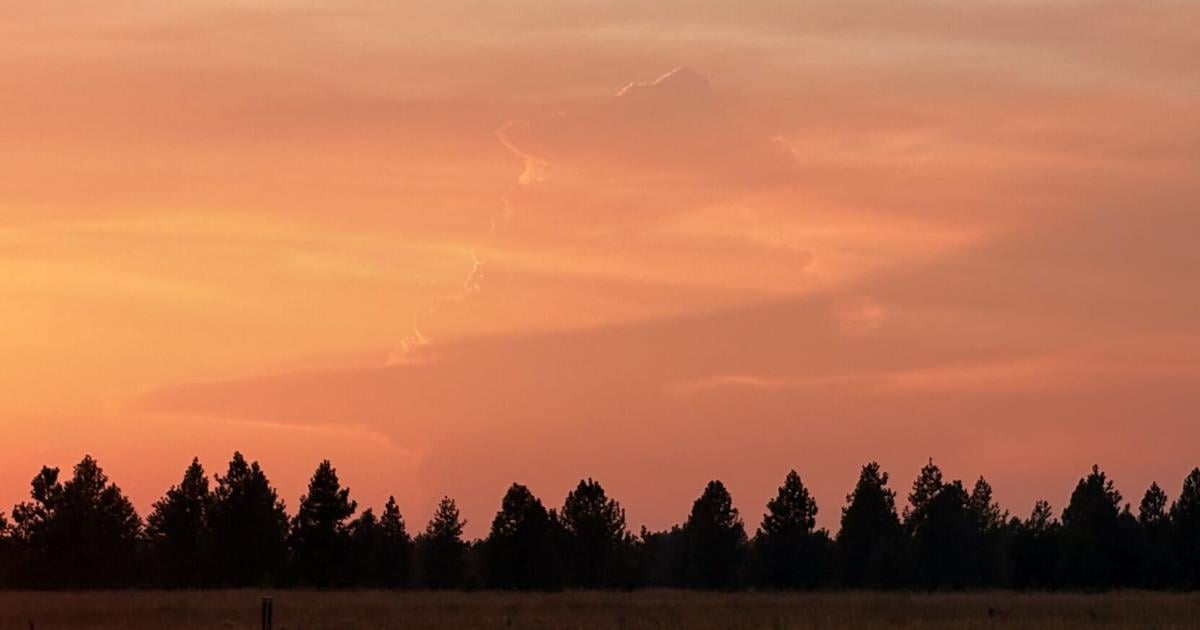
SPOKANE, Wash. -- A fast-growing fire cast a long shadow across the Inland Northwest. Framed by the setting sun, a 4 News Now viewer in Colbert captured the gigantic plume of smoke and cloud on Tuesday evening.
The top section of this plume is what's called a pyrocumulus cloud ( pyro meaning fire). It is an actual cloud formed by the smoke and fire below it. The intense heat from the fire and smoke particles rising into the sky helps to condense water vapor efficiently, even in what is otherwise a dry atmosphere.
In the most extreme cases, these clouds can become pyrocumulo nimbus clouds and produce strong winds and lightning. According to the National Weather Service, the top of this cloud reached 35,000 feet high.
In other words, the fire is creating its own weather above it.

 The Columbian
 FOX 13 Seattle Crime
 Newsweek Top
 People Shopping
 The Fashion Spot
 Planet F1
 Local News in California