
 KSNB Local4 Central Nebraska
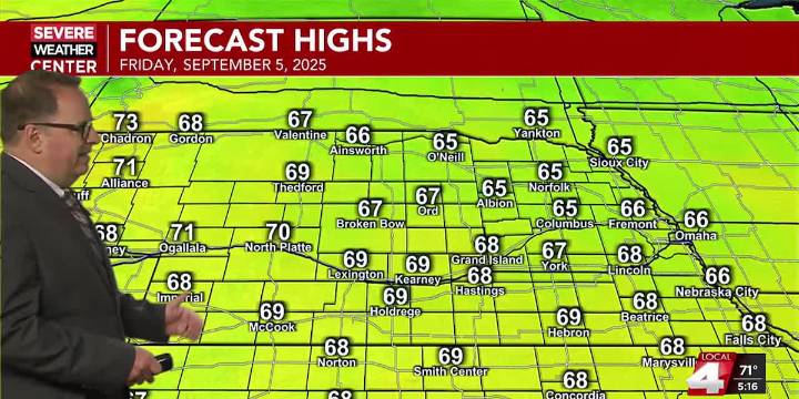
HASTINGS, Neb. (KSNB) - Good Thursday evening everyone! Our second cold front in as many days will quickly push southeast through the area this evening, bringing breezy northwest winds most of the area. Later this evening and into the late night, a disturbance will move in behind the cold front. This will produce some showers and isolated thunderstorms, mainly south of I-80. Some of these showers will linger into tomorrow morning. There is an outside chance this evening for an isolated stronger storm. That chance would be greatest over Northern Kansas. With a push of cooler and drier air diving south behind the front, low temperatures tomorrow morning will bottom out between the mid 40s north and the mid 50s south.
The lingering showers tomorrow morning for southern areas should be out by

 1011 Now Lincoln
 Reuters US Domestic
 Cover Media
 FOX News Travel