
 Idaho News 6
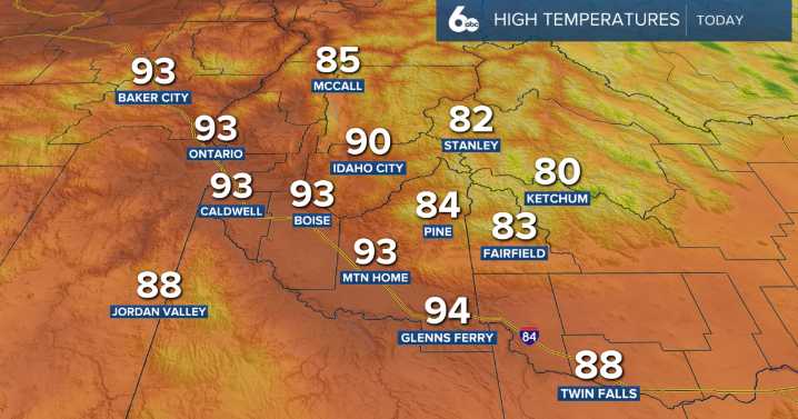
Happy Friday to you!
A weakening ridge means temperatures will gradually cool heading into the weekend, But still we have a toasty afternoon on tap.
Idaho News 6
This afternoon, a few isolated showers and thunderstorms are possible across eastern Oregon, capable of producing gusty outflow winds up to 40 mph. In response to this, and low relative humidity values a red flag warning is in place along Baker City, and La Grande. Avoid outdoor burning in those areas.
Idaho News 6
On Saturday, an upper trough sitting just off the northern California coast will interact with mid-level moisture, boosting storm chances. Thunderstorm coverage looks highest in southwest Idaho’s highlands (40–60% chance) and eastern Oregon (20–40%). A few storms could pop up north and east of the Snake Plain as we

 KPTV Fox 12 Oregon
 People Crime
 Bored Panda
 America News
 The radio station 99.5 The Apple