
 The Oregonian Public Safety
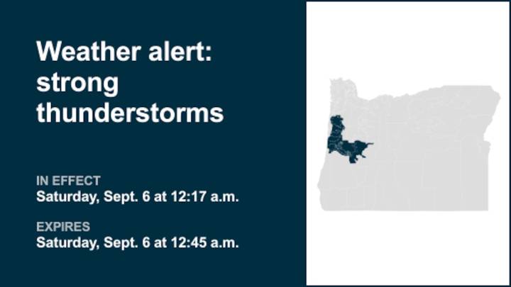
The National Weather Service issued a weather alert at 12:17 a.m. on Saturday for strong thunderstorms until 12:45 a.m. for Central Oregon Coast Range Lowlands, Central Oregon Coast Range, Lane County Lowlands and Lane County Cascade Foothills.
The storms are packing penny-sized hail (0.75 inches) and wind gusts of up to 40 mph.
"At 12:17 a.m., Doppler radar tracked a strong thunderstorm over Creswell, or 12 miles south of Eugene, moving northwest at 15 mph," comments the weather service. "Gusty winds could knock down tree limbs and blow around unsecured objects. Minor hail damage to vegetation is possible."
Locations impacted by the alert include Eugene, Creswell, Walker and Saginaw. In Oregon this includes Interstate 5 between mile markers 176 and 184.
The weather service states, "If

 Charleston Gazette
 Tucson News Now
 Corpus Christi Caller-Times
 WKOW 27
 FOX 13 Tampa Bay Crime
 Plano Star Courier Sports
 The Washington Post
 FOX Weather
 The Weather Channel
 KTAL-TV
 The Hill Politics