
 MassLive
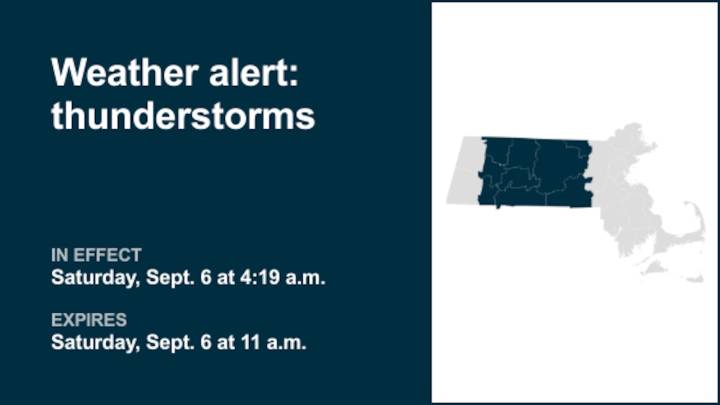
The National Weather Service issued a report at 4:19 a.m. on Saturday for thunderstorms until 11 a.m. for Northern Worcester and Southern Worcester as well as Franklin, Hampshire, Hampden and Middlesex counties.
"A cold front brings potential for scattered severe thunderstorms today to interior southern New England. Thunderstorms may begin to pop-up across eastern New York, along the border with Connecticut and Massachusetts early as 12-2pm. There after is prime time for storms to build develop, between 2-6pm, across the interior of southern New England. Expect thunderstorms to weaken as the line shifts to the I-95 corridor between 7-10pm. Thunderstorms will have the potential to produce straight-line damaging winds, hail, localized flash flooding in urban areas or locations of poor drain

 Charleston Gazette
 The Washington Post
 CNN
CNN Tucson News Now
 FOX 13 Tampa Bay Crime
 Corpus Christi Caller-Times
 WKOW 27
 Plano Star Courier Sports
 10 Tampa Bay
 FOX Weather
 New York Post Video