
 WTKR
WTKR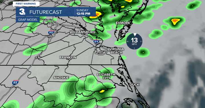
Meteorologist Tony Nargi's First Warning Forecast
Today will be the last day of the hot and humid stretch, with high temperatures reaching the low 90s for most of the region, with mid to upper 80s along the Outer Banks. Dew points will be in the 70s, leading to "feels like" temperatures in the upper 90s. Winds will be out of the S at 5-15 mph. This afternoon a cold front will approach, with increasing thunderstorm chances this evening. Isolated severe storms could produce some strong wind gusts for western parts of our area, including Williamsburg, Yorktown, Wakefield, and Northampton county in NC. Surf height will be between 2 and 3 feet, with a low risk of rip currents.
Tomorrow will start off cloudy with temperatures in the upper 60s and low 70s with occasional showers and isolated th

 WSMV 4 Nashville
 WBRC
WBRC CNN
CNN The Washington Post
 Charleston Gazette
 KPTV Fox 12 Oregon
 Tucson News Now
 Corpus Christi Caller-Times
 FOX 13 Tampa Bay Crime
 Ocala Star-Banner
 West Kentucky Star
 WKOW 27
 NBC News NFL