
 WSVN 7 News
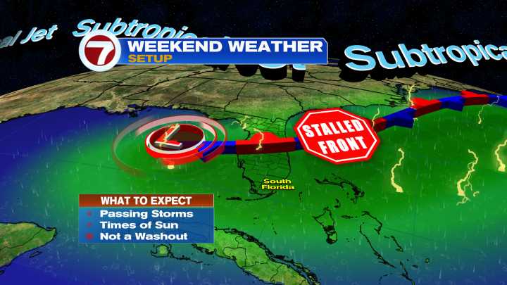
This weekend is shaping up to be another wet one across South Florida. A stalled frontal boundary to the north combined with a surge in deep tropical moisture will send rain chances soaring across the area this weekend. The highest chances will be in the afternoon, where heavy downpours could lead to some flooding issues.
Saturday and Sunday look like a carbon copy from a forecast standpoint. The pesky stalled frontal boundary to our north will linger for at least the rest of this weekend. This will focus a surge of tropical moisture over the area, leading to higher storm chances each day. Both Saturday and Sunday will start off with steamy sun and a few spotty storms, especially just offshore and into the Keys. Steamy sun will send temps soaring to around 90 degrees, with the heat index

 Local News in New York
 CNN
CNN The Washington Post
 Charleston Gazette
 KPTV Fox 12 Oregon
 Tucson News Now
 Ocala Star-Banner
 Corpus Christi Caller-Times
 FOX 13 Tampa Bay Crime
 Crooks and Liars