
 KTIV News 4
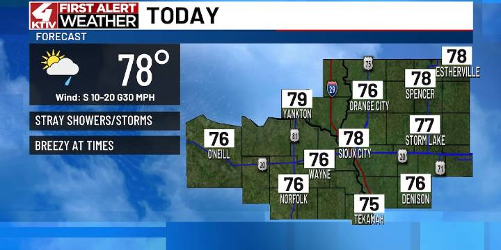
SIOUX CITY (KTIV) - Sioux City recorded a couple of new record lows this weekend. Temperatures bottomed out in the 30s both Saturday and Sunday morning. Our stint of cool fall weather will end this week.
MONDAY
Not as cool of a morning with temperatures ranging in the 50s to start the day. A stray shower and rumble of thunder cannot be ruled out south of Highway 20 this morning. Coverage will be limited.
Wildfire smoke is forecasted to return to the sky today. Surface impacts are possible, mainly in western Siouxland.
We’ll dry out in the afternoon. A southerly breeze up to 30mph will help temperatures warm into the mid and upper-70s with more clouds than sun. That southerly wind will also increase our humidity. While humidity will not be oppressive, it will be noticeable after how dry

 KXAN Austin
 FOX 8 News
 WJBF-TV
 KIMT News 3
 KWWL
KWWL Spectrum News Louisville
 The Des Moines Register
 New York Post
 FOX News Videos
 Mediaite
 Raw Story