
 Manchester Evening News Home
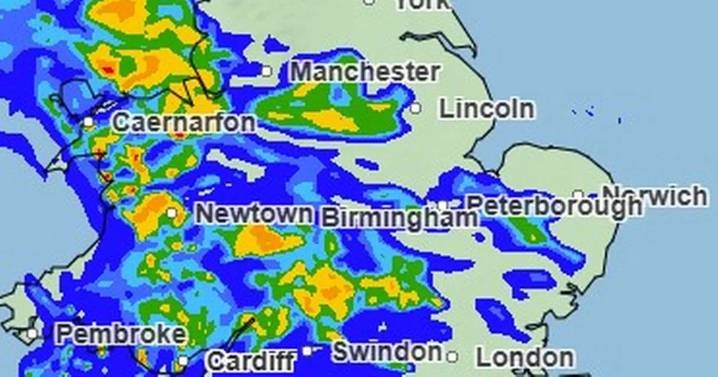
The latest Met Office weather map shows a 'huge wall of rain' forecast to hit much of the UK late Sunday afternoon, as speculation grows over whether the first named storm of the year could arrive this weekend.
An update issued by the UK's national weather service suggests much of the country will continue to experience unsettled conditions over the coming days, with a mix of heavy rain, thunderstorms, and strong winds affecting many areas.
The Met Office said Friday will be breezy, with showers feeding into western coastal areas overnight before becoming more widespread during the day.
These showers may be heavy in places, with isolated thunderstorms likely and some merging into more organised bands of rain.
Stronger winds and coastal gales are also possible.
The driest conditi

 Mirror
 Task and Purpose
 The Times Herald Sports
 AlterNet
 Ann Arbor News Life
 New York Post Video
 CNN Video
 The Atlanta Journal-Constitution Things to do
 The Conversation