
 USA TODAY National
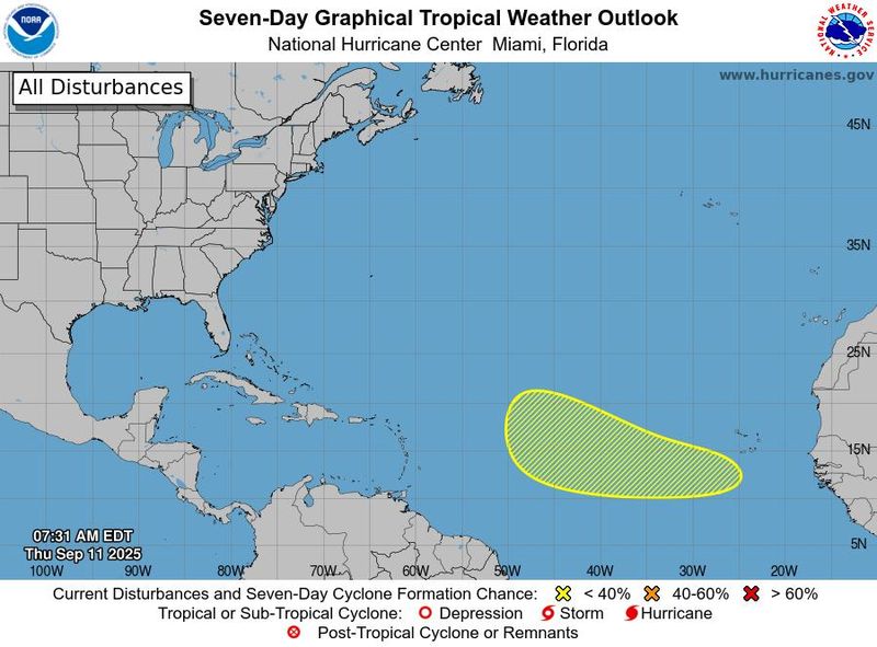
The tropics are awakening from their midseason slumber.
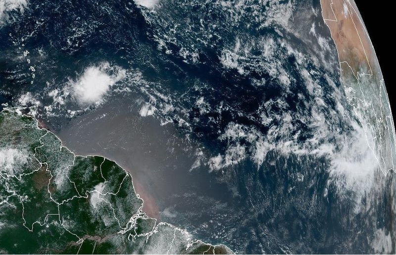
In the Atlantic, a tropical wave is forecast to emerge off the west African coast in the next couple of days. "Environmental conditions could support some slow development of the system over the weekend into early next week," the National Hurricane Center said Sept. 11.
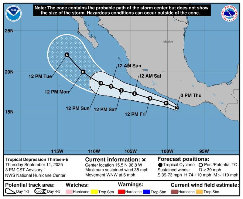
And in the Pacific, an area of showers and thunderstorms off the southern coast of Mexico became a tropical depression on the afternoon of Sept. 11.
Atlantic storm could be Gabrielle
As for the system in the Atlantic, it "should find favorable conditions for further development," noted Houston-based meteorologist Matt Lanza in his "Eyewall" Substack on Sept. 11.
If it eventually becomes a named storm, it would likely get the name Gabrielle.
"Most of the various models we look at … have become fairly bullish on development of this system about a week from now," Lanza added. "There is surprisingly good agreement among several of these models, and their ensembles, about where the disturbance will be by the middle of next week" ‒ namely, about smack-dab in the middle of the Atlantic Ocean.
WPLG-TV hurricane specialist Michael Lowry said on Substack Sept. 11 that "for now at least, the system poses no immediate threat to land, It’s nothing for us back stateside to worry about at this time."
However, Lanza warned that "this is something we are going to have to pay attention to for awhile, since the second half of September can see storms get pretty strong, pretty quickly. It could be something. It could be nothing. We'll see!"
Mario likely to form in Pacific
In the Pacific, a low-pressure area became a tropical depression on the afternoon of Sept. 11. It is forecast to move west-northwestward in the ocean, roughly parallel to the coast of south and southwestern Mexico, but offshore, the hurricane center said.
As of 5:00 p.m. ET Sept. 11, the depression, dubbed Tropical Depression 13-E, was located about 120 miles southeast of Acapulco, Mexico, the hurricane center said. The system is expected to become a tropical storm in a day or so.
"Interests along the coast of southwestern Mexico should monitor the progress of this system," the hurricane center said. Rainfall totals of up to a half foot were possible, potentially leading to flash flooding in areas of higher terrain.
Since the system will track over warm water, it "should become a hurricane, and potentially a major hurricane" noted Weather Trader meteorologist Ryan Maue in his Substack post.
The next name on the storm list for eastern Pacific systems is Mario.
AccuWeather revises hurricane prediction
AccuWeather released a revised prediction for the 2025 Atlantic hurricane season Sept. 11, following an "unusually quiet stretch across the Atlantic basin during the climatological peak period of tropical activity."
The new forecast and how it compares to the March forecast (in parentheses) is:
- Named storms: 13-16 (13-18)
- Hurricanes: 6-9 (7-10)
- Major hurricanes: 3-5 (the same)
- Direct U.S. impacts: 3-6 (the same)
This Atlantic hurricane season is now pacing a bit behind the historical average, according to AccuWeather. Six named storms have formed in the Atlantic basin, and only Erin strengthened into a hurricane. By this point in the year, there are typically eight named storms and three hurricanes.
Contributing: Dinah Voyles Pulver, USA TODAY; Cheryl McCloud, USA TODAY Network Florida
This article originally appeared on USA TODAY: New storm threats emerge in both Atlantic and Pacific as tropics awaken
Reporting by Doyle Rice, USA TODAY / USA TODAY
USA TODAY Network via Reuters Connect

 NOLA
NOLA News4JAX
 The Free Press - TFP
 NBC News
 KCRA News
 TMJ4 News
 WTOP
WTOP Gainesville Sun Sports
 Mindbodygreen Beauty
 AlterNet
 Political Wire