
HASTINGS, Neb. (KSNB) - It’s been an active start to our Tuesday evening with multiple severe thunderstorms in western parts of the area. Have had reports of tennis ball size hail earlier in the McCook area along with very heavy rainfall. A severe thunderstorm watch remains in effect until 10pm CDT for areas along and west of highway 283. As these storms push eastward this evening, congealing into a large cluster of rain and thunderstorms, damaging wind gusts will become the main threat. Another thing worth mentioning is the possibility of heavy rainfall in excess of 2 to 4 inches. This could lead to some localized flash flooding. Showers and thunderstorms will continue pushing eastward into more of the area later this evening and overnight tonight. As this happens, the thunderstorm activi
An active weather pattern kicks off this evening with the potential for severe storms
 KSNB Local4 Central Nebraska3 hrs ago
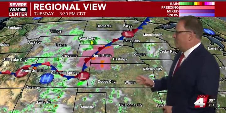
2

 America News
 Local News in Illinois
 The Tennessean
 AccuWeather Severe Weather
 FOX Weather
 Raw Story
 New York Post Video
 FOX 32 Chicago Sports