
 KGET 17 News
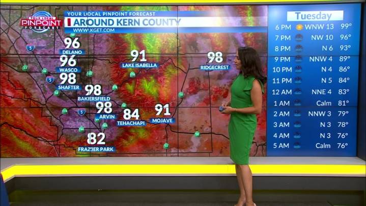
BAKERSFIELD, Calif. (KGET) -- Tuesday will be the warmest day of the week as the ridge of high pressure continues to dominate.
However, high temperatures will remain close tomorrow, but moisture from the Baja coast could trigger some dry thunderstorms.
On Thursday, the ridge will begin to tilt its axis towards the northeast as it moves east allowing the remnants of Mario to move closer to California. Thunderstorm chances increasing to 15 to 25% for Kern County and 5 to 15% across much of the Sierra Nevada and the west side of Kern County.
Rain chances increase on Friday as there is a 25 to 40% probability of a quarter inch or more of rain in many valley locations.

 The Daily Beast
 New York Post
 Taste of Home Recipes
 ABC 7
ABC 7 Los Angeles Times
 Detroit News
 NBC Chicago Entertainment
 Blaze Media
 People Top Story
 Vogue
Vogue