
 Newsweek Top
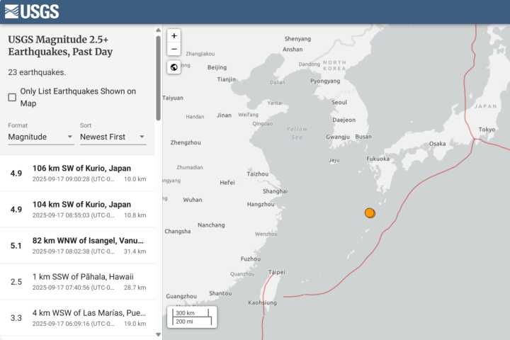
Two strong earthquakes shook southern Japan Wednesday, the United States Geological Survey (USGS) map shows.
The quakes were both measured at a 4.9 magnitude and were 106 km, about 65 miles, and 104 km, about 64 miles, off the southwest coast of Kurio, according to the USGS map.
They struck about five minutes apart, according to the data from USGS.
No damage or injuries have been reported, and no tsunami warnings have been issued.
The location of the quakes is off of the Tokara Islands, a remote archipelago in southern Japan which is known for its seismic activity.
It sits above the Philippine Sea Plate Subduction under the Eurasian Plate, leading to frequent earthquakes.
From June to July, the region recorded over 2000 earthquakes, according to a report from Nippon.com.
This is a

 FOX Weather
 Shelby Star
 AccuWeather Severe Weather
 KPTV Fox 12 Oregon
 WVLT
WVLT Raw Story