
 WTNH News 8
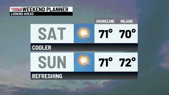
A beautiful and warm end to the week! A cold front has crossed Connecticut, and now a northwest wind will usher in cooler temperatures for this last weekend of summer--definitely a taste of fall! We will officially welcome fall on Monday at 2:19 PM. Monday will be nice and comfy with highs in the mid-70s. Tuesday will feature a return to that mid-summer feel with late afternoon/evening showers/thundershowers with another cold front. Some shower action is possible on Wednesday, with still high humidity. We could use the rain(see below), but not as much as northern New England--Maine, New Hampshire, and Vermont are experiencing severe to extreme drought conditions.
Note: Sunday is the 87th Anniversary of the HURRICANE OF 1938(SEE BELOW)
Tonight: Mostly clear. Lows in the mid-upper 40s inla

 abc27 News
 KLFY News 10
 KOMU 8
 AccuWeather Severe Weather
 NBC Connecticut
 WJZ CBS Baltimore
 FOX 32 Chicago
 The Burlington Free Press
 Fox 26 Liberty County
 NewsTalk 1280
 Nogales International
 Cache Valley Daily