
 WKOW 27
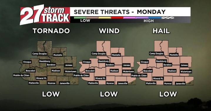
Download the 27 StormTrack Weather app to receive mobile weather alerts
Although the start of our Monday is dry and foggy, we do have a chance for some shower and storm activity in the near future. A warm front has slowly crept across southern Wisconsin overnight, but a cold front moving through later today will force that warmer air to rise and lead to the development of showers and storms. We are under a level 1 out of 5 risk of severe weather with our best chance for stronger storms coming in the afternoon and evening. While widespread severe weather is not expected, isolated strong winds or small hail will be possible. The best chance for this will be for the areas that get the most sun before storms move in, as the warming associated with this provides energy for storms. Madison is e

 Associated Press US and World News Video
 CBS DFW
 KSNB Local4 Central Nebraska
 Democrat and Chronicle
 Hawaii News Now
 The Oregonian Public Safety
 CW39 Houston
 Hattiesburg American
 FOX 10 Phoenix Latest
 Associated Press Top News