
 KTOO
KTOO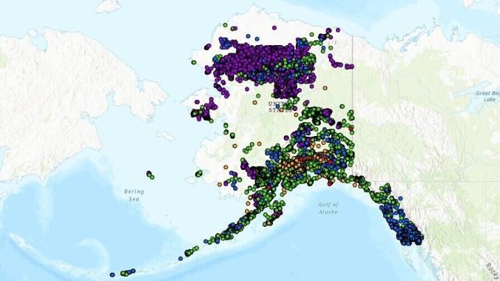
For years, a national database that tracks and maps landslides has had a major hole: Alaska.
That’s about to change. The state released a database this week that pinpoints where thousands of slides have happened in the past. The aim is to better understand the risk and prepare for the future.
It’s a crucial tool that will help communities, researchers and government agencies “start extrapolating if there are certain slope angles with certain soil types or rock types that are more susceptible than others,” said Jillian Nicolazzo, a geologist with the state’s Landslide Hazards Program.
Staff at the Alaska Department of Natural Resources created the inventory over the last three years by poring over more than 1,000 geologic reports, most of which date back to the 1950’s.
Those reports

 America News
 KTVU Latest
 WCNC Charlotte Weather
 The radio station 99.5 The Apple
 KSN News
 CNN
CNN Hollywood Life Celebrity News
 AlterNet