
 Click2Houston
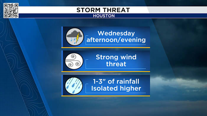
The KPRC 2 weather team is tracking a cool front that brings not only a break from the oppressive late summer humidity, but a chance to see some strong to severe thunderstorms Wednesday afternoon.
Let’s break down the timing and the threats:
Cool front timing:
Brazos Valley/Northern Counties: 11 a.m. - 2 p.m.
We’ll start to see a line of broken storms as the front pulls away from the I-20 corridor, and enter the northern counties and the Brazos Valley around lunchtime.
Houston Metro: 2 p.m. - 6 p.m.
This is where the forecast may get a little tricky. The leading edge of the front is expected to hit the Houston metro around 3 p.m. to 4 p.m. This could also be the time that the sea breeze storms that will be pulled in ahead of the front arrive at the same time.
If that’s the case, we

 Newsweek Top
 CNN
CNN FOX 4 News Arlington
 THV11
THV11 Fox 26 Liberty County
 PaperCity Magazine
 The Texas Tribune
 KXAN Austin
 KXXV
KXXV CBS News