
 CNN Climate
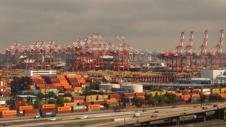
Shipping containers sit on the dock at the Port Newark Container Terminal in Newark, New Jersey, on June 10. Gary Hershorn/Getty Images
A new interactive map and groundbreaking database allows people in the world’s largest metropolitan areas to track their air pollution exposure, along with their region’s biggest sources of planet-warming pollution.
The tool, which depicts air pollution plumes and their sources, is the work of a nonprofit coalition of scientists, universities and nongovernmental groups called Climate TRACE . The group says the tool is a breakthrough in showing the biggest sources of air pollution down to the facility level for about 2,500 urban areas worldwide.
The new data, which combines hazardous air pollutants known as PM2.5 and greenhouse gases, taps into Clima

 NBC News
 The Washington Times
 Newsweek Video
 Orlando Sentinel Politics
 The Spectator
 IndyStarSports
 Raw Story
 The List