
 Lehigh Valley Live
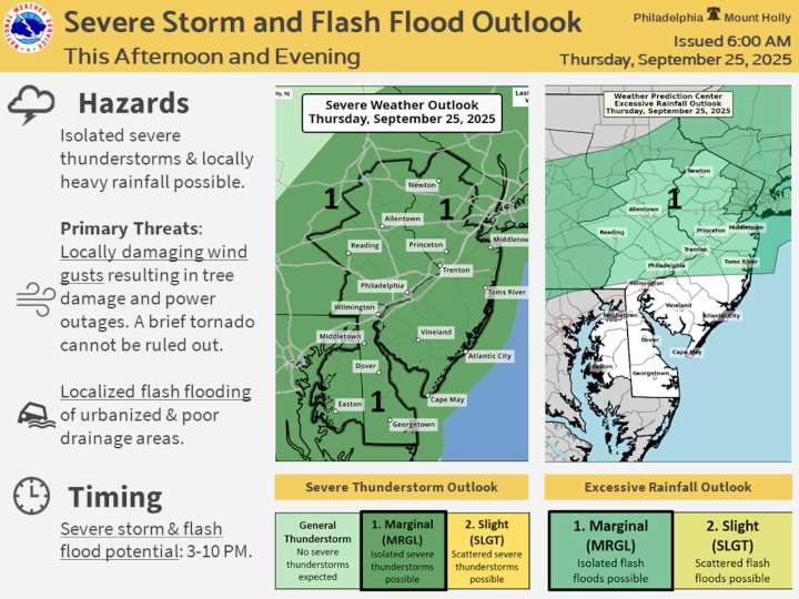
A warm front and approaching cold front will bring scattered showers and thunderstorms to the Lehigh Valley on Thursday, with a marginal risk of severe weather and potential damaging wind gusts. Residents should be prepared for intermittent rainfall and possible thunderstorm activity throughout the day.
After patchy fog to start the morning, ongoing showers are expected, particularly over eastern Pennsylvania. Temperatures will reach the mid to upper 70s, with cloud cover limiting peak temperatures. A second round of showers and thunderstorms is expected to develop mid to late Thursday afternoon, continuing into the evening hours.
The National Weather Service has issued a marginal risk for severe weather across the region , with the primary threat being damaging wind gusts. There is

 Associated Press US News
 Atlanta Black Star Entertainment
 CBS News
 WYMT Sports
 Daily Kos
 The Hollywood Reporter TV
 NBC 7 San Diego Entertainmet