
 Cache Valley Daily
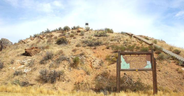
DOWNEY - Red Rock Pass is a geological phenomenon on the northern end of Cache Valley that may be overlooked by some who pass by it. The pass is close to Downey, Idaho on Hwy 91 at milepost 30.2. It is approximately 20 miles from Preston. The pass is about two miles wide.
There is a historical marker that marks the pass as a place where the edge of Lake Bonneville burst, sending floodwaters west into the Snake River.
To scale the hill by the highway marker there are 76 stairs to climb, leading to the top at the overview where there is an old monolith.
At one time the pass was 300 feet higher and was the shoreline of Lake Bonneville, the Pleistocene body of water that covered as much as 32,000 square miles in Northwestern Utah and Southern Idaho.
Lava flows in the vicinity of Pocatello

 The Danville Register & Bee Politics
 CNN
CNN Reuters US Top
 VICE
VICE Nola Entertainment
 WSAZ NewsChannel 3
 WKYT
WKYT The Daily Beast