
 FOX Weather
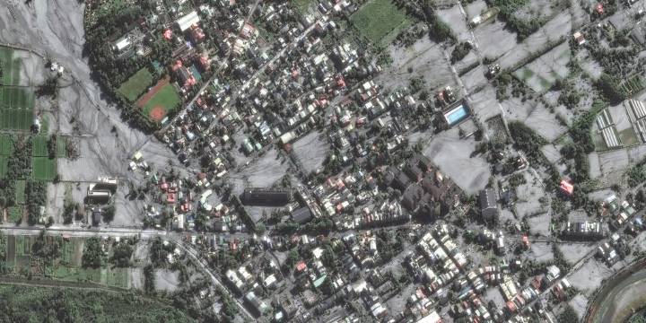
TAIPEI, Taiwan – Newly released satellite imagery shows the impacts from storm surge and flooding produced by Super Typhoon Ragasa as it passed through the Luzon Strait on a trajectory toward China.
The images, released by Maxar, a space technology company based in Colorado, showed bridges destroyed, farmland inundated by floodwater and large swaths of southern Taiwan coated in thick debris.
Many streets appeared to be covered by silt and mud as both lakes and streams overtopped their banks, raising concerns about the stability of infrastructure.
"Many of the streets in Guangfu remain covered with mud and silt and similar damage is seen in farms and fields along the outskirts of the city," Maxar stated. "Nearby, the Matai’an Creek Bridge has been destroyed and washed away from the flood

 Star Beacon
 The radio station 99.5 The Apple
 CBN Christian World News
 CNN
CNN FOX Carolina
 NBC Southern California Entertainment
 AlterNet
 Iron Mountain Daily Sports
 The Fashion Spot
 Los Angeles Times World