
 The Tribune
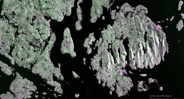
The first images from the joint NASA-ISRO satellite show a snapshot of the American landscape ranging from narrow waterways, islets dotting the fringes of an island, forests and wetlands, and large swathes of farms.
The first pictures from the NASA-ISRO Synthetic Aperture Radar (NISAR) satellite, billed as the most expensive satellite ever built, were released by NASA earlier this week.
A photograph of Mount Desert Island on the Maine coast, captured on August 21, shows narrow waterways cutting across the island, as well as the islets dotting the waters around it.
On August 23, the L-band SAR captured data of a portion of northeastern North Dakota straddling Grand Forks and Walsh counties.
The image shows forests and wetlands on the banks of the Forest River passing through the centre

 IMDb TV
 Raw Story
 The List
 The Daily Beast
 Atlanta Black Star Entertainment
 NBC News