
 ClickOrlando
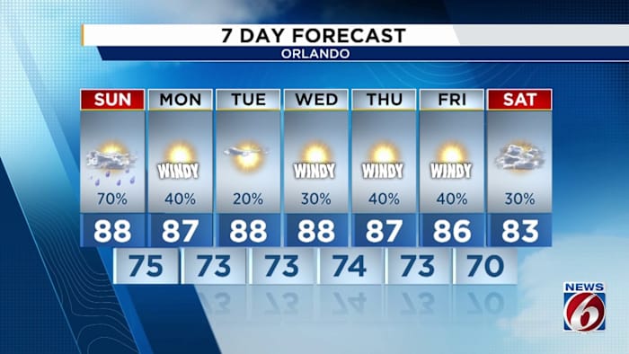
ORLANDO, Fla. – We’ve seen some pretty sporty thunderstorms in different corners of Central Florida today, all thanks to a cold front attempting to sweep west to east through our viewing area. Note how the colors and percentages increase the further east you go. Flow around tropical depression 9 and our lingering stationary boundary to our west will help to drive rains up during the afternoon (Copyright WKMG 2025)
Tonight we’re watching storms finally relax, and leftover showers mingle over north and eastern Florida. Lightning could stick around until the early morning hours of your Sunday, but nothing intense is forecasted to start the day tomorrow.
Once we start rolling into the warmest parts of the afternoon, rains will ramp back up quickly as we tap into two moisture sources. Mi

 Law & Crime
 The Traverse City Record-Eagle
 WPTV West Plam Beach
 WWSB
WWSB First Coast News
 FOX 51 Gainesville Crime
 FOX 13 Tampa Bay Crime
 AlterNet
 Atlanta Black Star Entertainment