
 ABC4 News
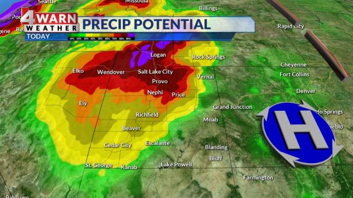
SALT LAKE CITY (ABC4) — Happy Tuesday, Utah! Showers and storms will continue to move from the I-15 corridor and western Utah into northeast and eastern Utah Tuesday afternoon into the evening hours. Look for most of the shower activity to come to an end by midnight.
At this time severe storms are not expected with this activity, but heavy rain, frequent lightning, and gusty winds will all be possible. The north & western half of Utah is under a "marginal" risk for flash flooding thanks to the big downpours and slow movement of any storms.
High pressure settles back in over the state mid to late week bringing more sunshine and warm temperatures to the region. Highs will be in the 70s for northern Utah, with mid to upper 80s returning to SW Utah. • 4Warn Weather • 4Warn Weather • 4W

 Associated Press US News
 WAND TV
 FOX 13 News
 Esquire
 Women's Wear Daily Retail
 NBC10 Philadelphia Sports