
SALT LAKE CITY (ABC4) — Happy October, friends! Happy Wednesday, Utah! We have a beautiful, sunny and pleasant midweek ahead of us for the entire state. The storm system that brought plenty of rain to the Wasatch Front Tuesday has exited the region allowing for a drier southwest flow to take over. High pressure to our south will build over Utah today and tomorrow, so we will see temperatures snap back to average, and even slightly above it, through Thursday. You can expect daytime highs to hit the mid to upper 70s along the Wasatch Front, a range of 70s throughout the central Utah and low to mid 80s throughout the lower elevations in Southern Utah. Enjoy these seasonal highs while you can, because it looks like we have another chance of temperatures tumbling by the close of the work week!
Beautiful October start with rebounding temperatures and dry conditions
 ABC4 News2 hrs ago
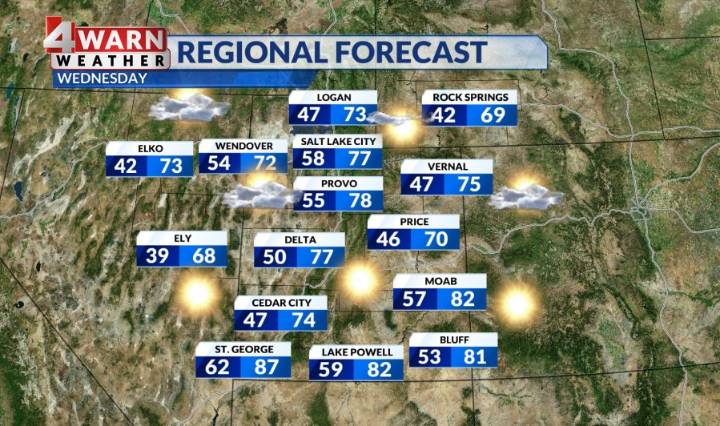
101

 KSLA News
 News Channel 36
 CBS News 8
 Raw Story
 Deseret News
 KFYR-TV
 NBC4 Washington