
 Space.com
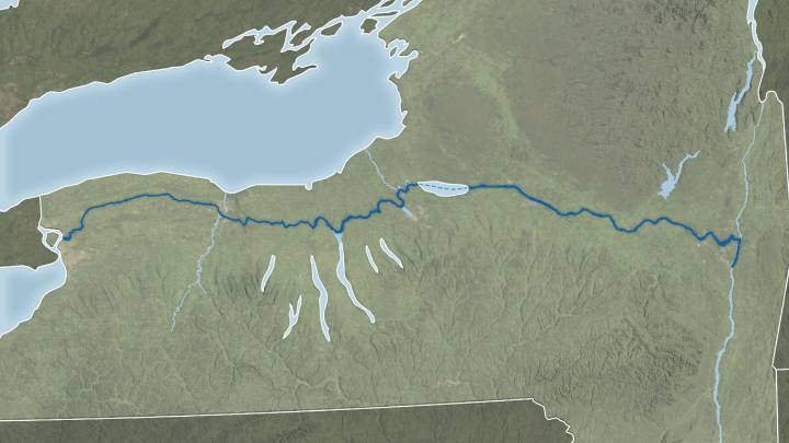
2025 marks the bicentennial of the Erie Canal, and NASA's Earth Observatory commemorated the milestone with a satellite-based image tracing the canal's historic route across New York State.
What is it?
According to NASA's Earth Observatory, the image combines shoreline data with the "Blue Marble: Next Generation" base map, which is constructed from imagery collected by NASA's Moderate Resolution Imaging Spectroradiometer (MODIS) aboard Earth-scanning satellites.
Where is it?
This image was taken from orbit above the Erie Canal.
Why is it amazing?
The Erie Canal was one of the defining projects of early America. Construction was completed in 1825, despite the lack of trained engineers at the time. Builders, often self-taught and guided by trial and error, created what was dubbed the "

 People Human Interest
 FOX 10 Phoenix National
 NBC Connecticut
 Las Vegas Sun
 Fox 11 Los Angeles Sports
 Cover Media
 NBC 5 Dallas-Fort Worth Entertainment
 The Hollywood Gossip
 The Daily Beast
 The List