
 ABC4 News
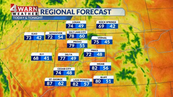
SALT LAKE CITY (ABC4) — Happy Wednesday, Utah! High pressure has returned to the state Wednesday and will likely hang out through Thursday afternoon bringing more sunshine and warm temperatures to the region. Highs will be in the 70s for northern Utah, with mid to upper 80s returning to SW Utah.
A deep trough of low pressure will swing overhead Friday afternoon into the weekend bringing much cooler weather and a good chance for more scattered showers & storms. Highs will only be in the mid 60s for northern Utah, and upper 70s for SW Utah. The mountains of Utah will likely see morning temps in the low to mid 30s with highs only in the 40s and 50s.
Due to the strong system dropping into the area, scattered showers will become more widespread late Friday night into Saturday morning, especia

 Raw Story
 Deseret News
 KFYR-TV
 KSL Utah
 Cover Media
 People Shopping
 New York Post