
 The Newport Daily News
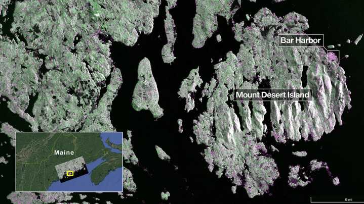
The two radar images, captured in August by the NISAR satellite, detail portions of both Maine's coast and North Dakota.
The NISAR mission is a joint venture between NASA and the Indian Space Research Organization (ISRO.)
The satellite, which launched July 30 from India, is designed to observe and map Earth in detail to provide scientists with measurements of some of the planet's most complex processes.
From there, decision-makers can use data to inform things like disaster response plans and agricultural management.
A new NASA Earth-observing satellite featured Maine’s coast in its first radar image .
The satellite, which was launched July 30, took the image of Maine on Aug. 21. It shows Mount Desert Island, an island off the north-central coast of Maine that's home to Aca

 Ocala Star-Banner
 KPIX 5
 El Paso Times
 FOX News Politics
 CBS Colorado Politics
 Associated Press US News