
 WOWT
WOWT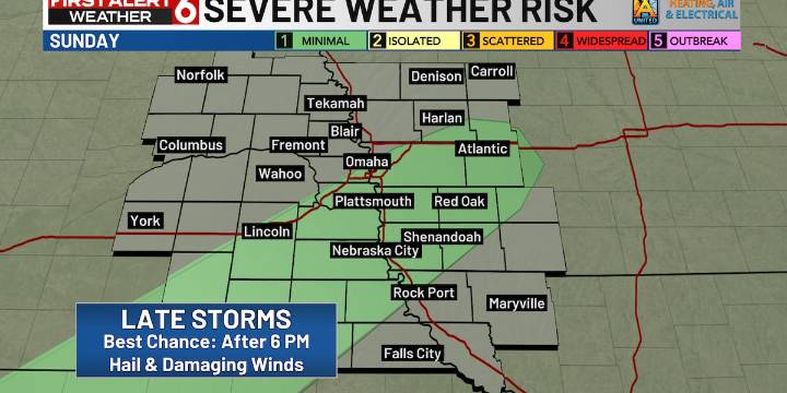
OMAHA, Neb. (WOWT) - Spotty showers did come through off & on, but the main round will still come tonight. Between 5-6 PM tonight, scattered thundershowers will begin to develop and continue through the night, particularly south of I-80.
The severe risk is still low; the main things to expect are some downpours, lightning, damaging winds exceeding 60+ mph and quarter size hail. A Level 1 Marginal risk has been issued for areas south of the metro.
Occasional showers and storms will be with us on Monday (particularly in the morning) along with persistent cloud cover. Because of the timing of the cold front, Monday’s high will occur around midnight early Monday in the mid 60s. During the day, temperatures will remain consistent in the lower 50s.
On top of the rain and rapid cooldown, winds

 1011 Now Crime
 KOLN-TV
 KSNB Local4 Central Nebraska
 @MSNBC Video
 The Daily Beast
 Spectrum News NY1 Politics
 FOX 32 Chicago Lifestyle
 Roll Call